

Allyson Randall Externship at United States Geological Survey (USGS) Idaho Water Science Center
 Having an education background in earth science, I’d always heard about the USGS as a potential job opportunity when in school, but never really knew what a day in the life of a government scientist looks like. When I learned about the teacher externship opportunity, I was delighted to be able to immerse myself in the Idaho Water Science Center, learning about the hydrologic work happening across Idaho. I was mostly based in the Boise Field Office for my externship, but I also spent some time getting a bit of exposure to what the studies section of the Center does. Both the Boise Field office hydrologic technicians and the studies section hydrologists are based in the same building near downtown Boise.
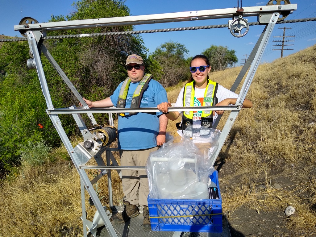
While I spent some of my time in the office working with data, many of my hours were spent out in the field measuring discharge and collecting water quality samples in waterways all over southern and central Idaho. This was my favorite part of the experience! As someone who loves being outside, enjoying Idaho’s beautiful wilderness, I was mesmerized at the idea of a job where you spend about half your time out along rivers and streams. I took day trips all over! Some of my favorite spots were McCall, Pine, Hailey, and Deadwood Reservoir. I also got to ride in cableways across the Boise and Snake rivers, something I’d always wanted to do when I’d see them places!
While I knew a bit from a recreation perspective about the discharge reporting the USGS provides for waterways across the country, I had no idea the reach of their data. It was fascinating to be involved and learn all about the different uses for the data and I can’t wait to bring that knowledge back to my classroom. While the USGS does not deal much with policy or decision-making, they are the scientific body driving a great deal of decision making. For example, the Army Corps of Engineers runs the Lucky Peak Dam and uses USGS data downstream and upstream to determine how much water needs to be replaced. This decision is an important one because if they don’t release enough, they risk the dam overflowing, but if they release too much, they risk running out of water before the dam gets recharged.
I am so grateful for the experience to work with the USGS and all the great connections I have made with scientists in Idaho. I can’t wait to share this experience with my students and work with them on some of the same science I worked on this summer.